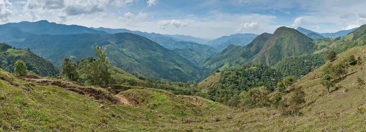
A single range runs the length of a continent. The Andes Mountains stretch roughly 8,900 kilometres along the western edge of South America, through Argentina, Chile, Bolivia, Peru, Ecuador, Colombia and Venezuela, per Wikipedia. Their average height is about 4,000 metres, high enough that entire capital cities sit where most of the world keeps only snow.
For a traveler, the range is less a destination than a set of rules. It decides where the rain falls, where the desert begins, and why a flight from Lima to Cusco climbs into a different climate in under an hour. Understanding the geography explains most of what a visitor will feel, see and eat.
How long and how high are the Andes, exactly?
The Andes are the longest continental mountain range in the world and the highest outside Asia. Wikipedia's overview records a length of 8,900 kilometres, a width that varies from roughly 200 to 700 kilometres, and an average elevation near 4,000 metres. The highest peak is Aconcagua in Argentina's Mendoza province, at 6,961 metres above sea level, the tallest mountain in the Western Hemisphere.
Two other figures reward the curious. Chimborazo, an inactive volcano in Ecuador, is the point on the Earth's surface farthest from the planet's center, because the equatorial bulge pushes the horizon outward there. And on the Chile-Argentina border stands Ojos del Salado, at 6,893 metres the world's highest active stratovolcano, according to WorldAtlas.
The range is not one wall but a stack of parallel cordilleras, split by deep valleys and high plateaus. The word itself comes from Spanish cordel, meaning rope, and the rope frays and re-braids all the way from the Caribbean to Cape Horn.
Why does one range hold three very different climates?
Because the Andes run nearly the full latitudinal span of a continent, they pass through tropical, desert and glacial zones, and altitude rewrites each one. The usual division is threefold: the Tropical Andes through Colombia, Ecuador, Peru, Bolivia and Venezuela; the Dry Andes through Chile, Bolivia and northwestern Argentina; and the Wet Andes of southern Chile and Argentina, per WorldAtlas.
The contrast can be abrupt. Rainforest can sit within miles of the snow-capped volcano Cotopaxi in Ecuador, while the snow line itself slides dramatically with latitude: between about 4,500 and 4,800 metres in the tropical northern Andes, rising to 4,800–5,200 metres in the drier central mountains, then falling to just 300 metres in Tierra del Fuego at the far south, per Simple English Wikipedia. From roughly 50 degrees south, many larger glaciers reach the sea.
The range also acts as a continental barrier. Moisture from the Pacific is wrung out or deflected, leaving the Atacama Desert on the western side of the Central Andes and the rain-shadow plains of eastern Argentina dry, while the northern Andes stay warm and rainy, with average temperatures around 18 °C in Colombia, according to Simple English Wikipedia. A traveler packing for one Andean trip is really packing for three.
How did the mountains form, and why do they still shake?
The Andes are young, in geological terms, and still under construction. They sit on the Pacific Ring of Fire, where the oceanic Nazca Plate slides beneath the South American Plate, a process called subduction. The collision, running from the Mesozoic era into the Tertiary period, folded and lifted the continental edge into the range seen today, per Wikipedia.
That same machinery keeps working. Subduction drives the earthquakes and volcanic activity that continue across the region, as WorldAtlas notes, and the range is bounded on the west by the Peru-Chile Trench, the very seam where the plates meet. The uplift also starved parts of the subduction zone of sediment, which changed how the plates grind past each other, a detail Wikipedia traces to the rain shadow the rising mountains cast over coastal Chile.
For visitors, the practical reading is simple: the dramatic scenery and the seismic risk come from the same source. The volcanoes, hot springs and shattered skylines are the visible face of an ongoing collision.
What did the Andes give the people who settled them?
High plateaus made high civilizations practical. The Altiplano, at roughly 3,750 metres, is the world's second-highest plateau after Tibet, and cities have crowded onto Andean high ground for centuries: Bogotá, Quito, La Paz, El Alto, Arequipa, Cusco, Santiago and Sucre all sit in or beside the range, per Wikipedia and WorldAtlas. Altitude offered defense, cooler air above the tropical lowlands, and valleys where water could be stored and moved.
The eastern flanks gave something else: water. The Amazon river system has its sources in the Andes' eastern slopes, per Simple English Wikipedia, meaning the range quietly feeds the world's largest rainforest basin.
The mountains also turned out to be a biological vault. Around 30,000 species of vascular plants grow in the Andes, and about half are found nowhere else, per Simple English Wikipedia. Among the crops that originated on these slopes are the potato and the cinchona tree, whose bark yielded quinine, long the standard treatment for malaria. Fauna runs similarly rich: WorldAtlas counts more than 1,000 amphibian species, two-thirds of them endemic, alongside some 1,700 birds and 600 mammals, from the vicuña and the chinchilla to the spectacled bear.
That living inventory still underwrites regional economies. Peru's alpaca fiber trade, the coffee farms of Colombia's steep slopes and the salt-and-lithium economy of Bolivia's high plateau all rest on geography this article can only sketch; the magazine's coverage of Peru's alpaca fiber economy and the Salar de Uyuni's two economies follow those threads in detail. We covered a connected angle in Salar de Uyuni: the world's biggest mirror runs on two economies.
What should a traveler know before going high?
The first lesson is that distance means little and altitude means everything. Climate changes sharply over short distances in the Andes, per Simple English Wikipedia, so a day's drive can cross three seasons. The second is that the high cities, La Paz and El Alto among them, sit at elevations where visitors commonly need time to adjust, though the sources here record the elevations rather than acclimatization advice.
Practical reading for the curious: the 1972 Andes plane crash remains the range's most examined survival story, and the living tradition of Andean textiles shows how the region's climate and history are woven, literally, into cloth. Both are covered elsewhere on this Andes desk. Readers following this should also see The Andes Plane Crash Story: What Really Happened in 1972.
What the sources establish is a range of superlatives with a human geography to match: the longest continental chain, the highest peak of two hemispheres, the world's second-highest plateau, and a set of environmental gradients so sharp that rainforest and glacier share a horizon. What they do not settle is the best way in. That depends on which of the seven countries, and which of the three Andes, a traveler chooses first.