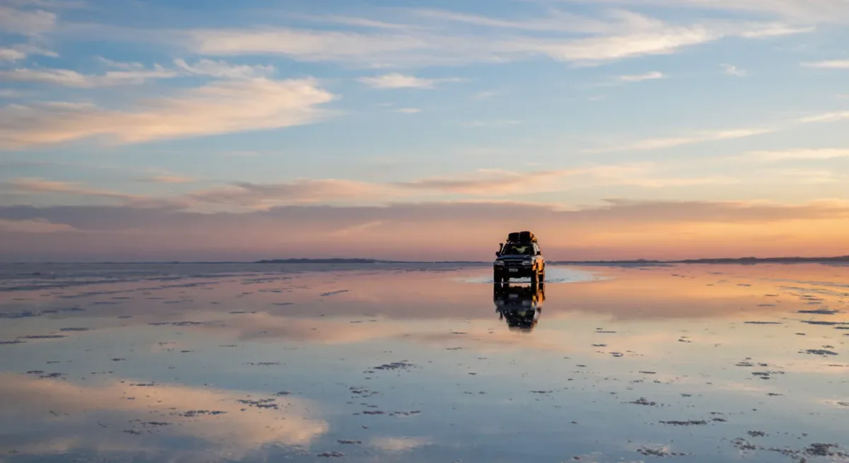
After the rains, roughly January through March, a few centimeters of water turn the Salar de Uyuni into a mirror with no visible edge — a phenomenon that has made the salt flat one of the most photographed places in South America and the anchor of Bolivia's international tourism. The rest of the year it is a blinding white crust of about 10,500 square kilometers, the largest salt flat on earth, sitting on brines that hold one of the world's largest lithium resources. The two facts — the mirror and the metal — define the same 3,600-meter plateau in Potosí department, and the tension between them is Bolivia's most interesting resource story (Geobol/sergeominem public geology; Ministry of Energy reports).
The tourism machine
The salar's visitor economy runs from the gateway town of Uyuni, a rail town reborn as a tourism hub, through 4x4 circuits that string the salt flat with the colored lagoons, rock islands — Incahuasi and its cactus forest — and the Eduardo Avaroa Andean Fauna National Reserve toward the Chilean border. Multi-day Uyuni-Antofagasta corridor tours have become a standard South American itinerary, feeding travelers to San Pedro de Atacama and effectively linking Bolivian and Chilean tourism products. The mirror season is the demand peak: hotels in Uyuni fill, salt-block hotels at the salar's edge book out, and jeep drivers — many former miners — form the industry's labor backbone. The money is regional and real, if seasonal and price-thin.
The lithium vault underneath
Geologists estimate the salar's brines hold on the order of 10 million tonnes of lithium, among the largest single resources known, and magnesium ratios that complicate — but do not preclude — commercial extraction. Bolivia's approach has been state-led since the 1990s: a national pilot plant, decades of engineering studies, then the YLB state company partnering with foreign consortia — Chinese, German, Russian and others over the years — for industrial-scale projects announced with regularity. Actual output has remained modest, and that record is the region's cautionary contrast: Argentina privatized toward a project queue, Chile produced through incumbents, Bolivia deliberated. The metal under the mirror has so far mattered more as potential than as production (USGS country summaries; Ministry of Energy announcements).
| Asset | Status |
|---|---|
| Salt flat area | ~10,500 km², world's largest |
| Lithium resource | ~10 million tonnes, among the largest known |
| Extraction model | State-led (YLB) with foreign partnerships |
| Tourism peak | Mirror season, roughly January–March |
Where the two economies collide
The overlap is literal. Evaporation ponds, plant sites and roads consume salar surface; tourism sells the emptiness. Local communities around the salar hold customary rights to both revenue streams — community agreements are a precondition for any industrial project, and tour operators depend on the same communities for campsites and routes. Water is the shared constraint: extraction draws aquifers in one of the driest inhabited places on the continent, and the flamingo lagoons that anchor the southern circuit are hydrologically connected to the same basin. Every industrial proposal has, so far, been negotiated against that geography.
What actually pays in Potosí
For all the lithium headlines, the region's functioning export is the itinerary: hotels, jeeps, guides, handicrafts and the quinoa-and-llama agricultural economy that tourism marginally supports. Mining in Potosí department remains overwhelmingly the Cerro Rico and associated zinc, lead and silver — the mountain that financed the Spanish empire and still employs thousands of cooperativistas in conditions no heritage designation erases. Against that backdrop, the salar's two futures — an industrial lithium province or a protected tourism-wilderness corridor — are not academic scenarios; they are the two planning documents the regional government actually holds.
How to see it well
Go in the mirror season if the photograph is the point, or in the dry winter for the geometrical white crust and easier driving. Book from Uyuni rather than committing to a border-crossing package unless time demands it; two days covers the salar and Incahuasi, three to four adds the lagoons and the red desert. Bring altitude discipline — nights on the circuit sleep above 4,000 meters — and spend one in a salt hotel to understand what the tourism economy built. And look down as well as out: the crust underfoot is the ceiling of the resource every battery maker on earth has read about.
How the lithium politics actually run
Bolivia's salt-flat governance is written into its constitution: natural resources belong to the Bolivian people and are administered by the state, a doctrine the 2009 charter raised to constitutional rank after decades of privatization disputes. The practical consequence for the salar is that every partnership — the Chinese consortium contracted for industrial plants, the Russian agreement signed in subsequent years, each announced with ceremony — is structured through the state company YLB, with terms negotiated in La Paz rather than in provincial capitals. That geography of decision-making is the standing grievance in Potosí: the department that owns the salt flat's surface and lives with its industrialization has mobilized repeatedly for a larger share of lithium rents, the latest chapter in a region whose name has been shorthand for extraction disputes since the colonial silver era.
The tension is structural, not incidental. National ownership maximizes sovereign control and headline bargaining power; local ownership — Argentina's model — maximizes project velocity and regional buy-in. Bolivia has chosen the first and paid in delay, while its neighbors' output grew. Whether the state-led path eventually delivers industrial-scale lithium remains one of the continent's open resource questions; what is settled is that Potosí will negotiate its share of whichever answer arrives.
For the fiber economy that shares the altiplano, read our feature on Peru's alpaca value chain — see the Andes section for more high-altitude reporting.